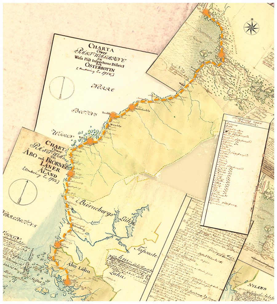
The history of the Ostrobothnian coastal road, which ran north from Turku, is intertwined with Sweden’s foreign policy, wars, trade and communications. The road was built slowly during the 17th and 18th centuries, and it eventually replaced the Kyrönkangas road, which ran inland.
Towns were not allowed to engage in foreign trade before 1765, so the coastal towns turned their attention across the Gulf of Bothnia to Sweden. After the restrictions on trading were lifted, there was a need to set up transport connections between the nearby areas. Ostrobothnia’s coastal road served a wide range of people, including soldiers, postmen and peasants travelling to towns.
The postal services were also an important reason for connecting the towns to each other via the coastal road. Communications in the 18th century meant the information contained in letters delivered by nominated peasant farmers. The king and his officials issued orders and instructions by letters, and his subjects also used the postal services for various purposes. The importance of the coastal road was even clearer during wartime and when the roads were not passable due to frost, as mail could not be delivered by the usual route from Stockholm via the Åland Islands to Turku; instead, letters had to be carried around the Gulf of Bothnia.
Letters passed through post houses along the postal route to post offices in towns. A decree of 1636 provided that towns had to have a post office where incoming and outgoing mail was handled and items were distributed to their recipients.
Mail had to continue its journey within half an hour of arriving at the office. The incoming mail was divided into bundles according to the delivery route. A list of recipients was attached to each bundle.
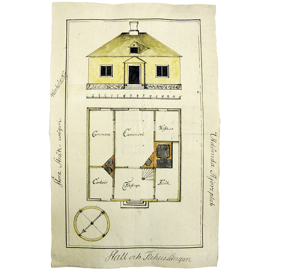
Drawing of the Vinkkilä post office from 1757. The building had a post office, bedrooms, and a shed for three cows and a horse. The Crown rarely funded the building of post offices. They were usually in the postmaster’s home.
Postal Museum
In the Swedish Empire, a person’s status was defined by their job, and the job was also passed on to the next generation. Working as a postmaster was restrictive as letters had to be received around the clock. The job required many skills. In addition to knowing the postal routes, postmasters had to be able to read, and this was not a common skill in the 18th century.
The wages that postmasters were paid varied. The system based on postage fees collected was replaced by a fixed salary in the late 17th century. Postmasters’ earnings were tax-free.
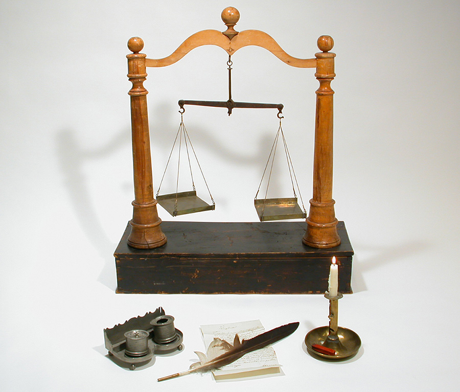
A postmaster needed different tools: a quill, an ink well and a sand shaker to write letters, and a candle and sealing wax to close them. The scales were used to weigh letters.
Postal Museum
The summer and winter roads that had been in use in the Middle Ages were replaced by more passable roads in the 17th century. People who lived along the roads were responsible for constructing and maintaining them. There were laws that prescribed how roads were to be built. The width depended on the use. What was new about the coastal road in Ostrobothnia was that the main road ran directly from town to town and side roads led to villages.
Shovels, pickaxes and ropes were used in the construction of the road. Hills were levelled out, rocks were cleared, and twigs were laid on the bottom and sand on top of the road. The condition of the roads was improved by draining peatlands. Streets were paved only in larger towns.
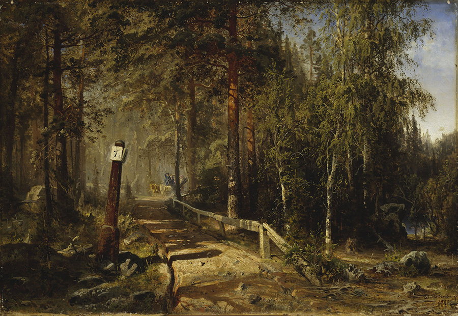
People travelled on roads on foot, by horse, sometimes by ox and cart. Werner Holmberg’s painting Postitie in Häme (‘A post road in Häme’) from 1860.
Finnish National Gallery
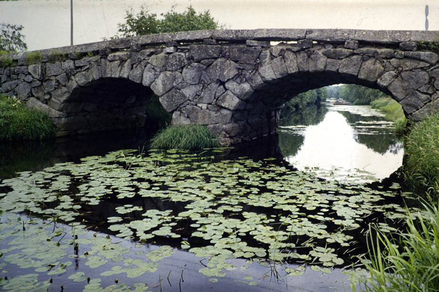
The skill of building arched stone bridges spread in Finland in the 18th century with the construction of the Suomenlinna fortress. Stone bridges made roads more passable especially in Ostrobothnia, where the spring floods destroyed wooden bridges. Bridge builders moved across Finland. People were initially suspicious of the vaulting technique.
The story has it that some life prisoners were ordered to remove the scaffolding at the Tuovilanjoki bridge on the Ostrobothnian coastal road. They were promised that they would be released if the arches held up.
Stone bridges were built to solve the problem caused by flooding in Ostrobothnia; the water swept wooden bridges away in the spring. The Tuovilanjoki bridge, built in the 1780s, is a masterpiece of the vaulting technology of its day.
Department of Architecture slide collection, Aalto University Archives.
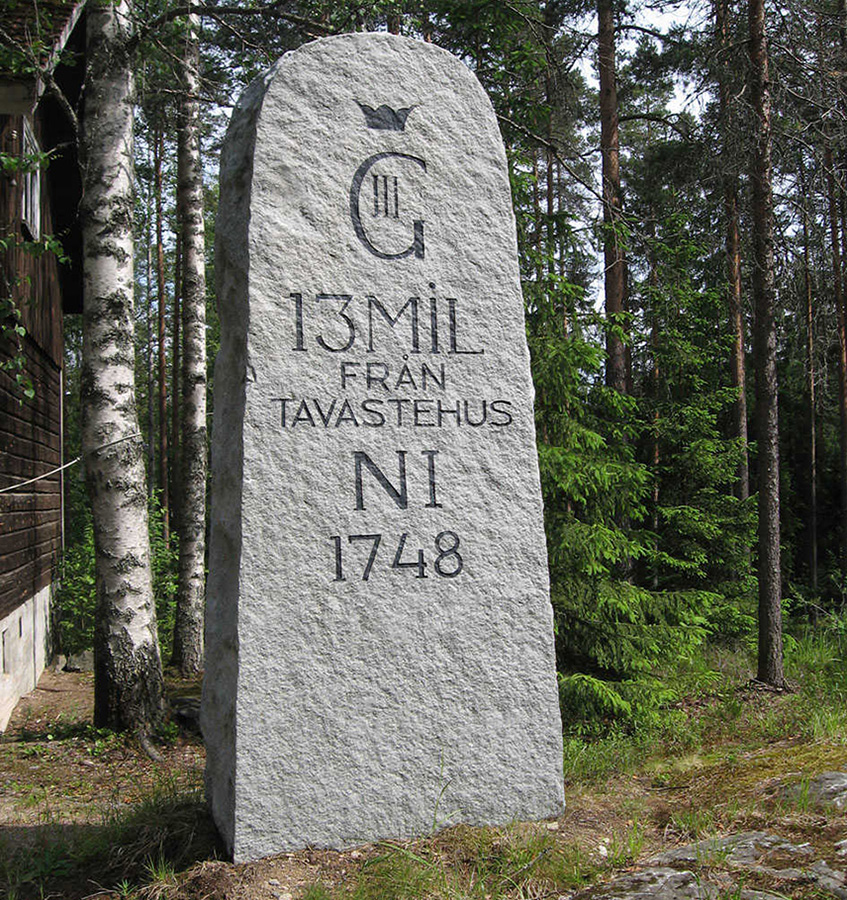
One of the requirements in the 1734 decree on road maintenance was that distances between towns had to be marked with milestones. The mil, or the Scandinavian mile, was used for measuring distance in Sweden. In 1665 the mil was defined to be the equivalent of 10.7 kilometres in the metric system.
The distance between two post houses was about three mils. Peasant farmers or their farmhands received letters and took them to the next house. They were supposed to do a mil in just over an hour, which was quick considering the road conditions at the time.
A copy of a milestone along the Laukaa road from the period when Finland was under Swedish rule. Stone posts replaced wooden posts. 1748 refers to the date the road was built.
Rauli Jakobsson
Peasant farmers who delivered mail were ordered in the 1650s to use main roads instead of shortcuts. Post offices were also placed along the roads to ensure that the distance between two offices could be covered on horseback.
Delivering mail was not necessarily quicker on horseback than on foot as the roads were in bad condition and horses were smaller than they are now. The speed was the same as on foot, about 5–10 km per hour, but a horse was able to carry heavier loads.
Redesigned in 1718, the postman’s badge features a postman on horseback blowing into a post horn. The new badge highlighted the most common way to deliver mail – by horse instead of walking.
Postal Museum
The Swedish army was composed of conscripts. Peasant farmers who delivered mail and postmen were exempt from conscription, taxes and other duties. After the Great Northern War (1700–1721), Sweden lost its position as a great power in northern Europe. Russia invaded the parts of Sweden that were east of the Gulf of Bothnia. A large number of postal officials fled to Sweden.
The war was followed by a period of severe hostilities when Russia occupied areas of Finland. Postal services and the development of transportation were disrupted. One of the areas to severely suffer from the Russian occupation was Ostrobothnia, where the construction of the road and communications networks had to start from scratch after the occupation.
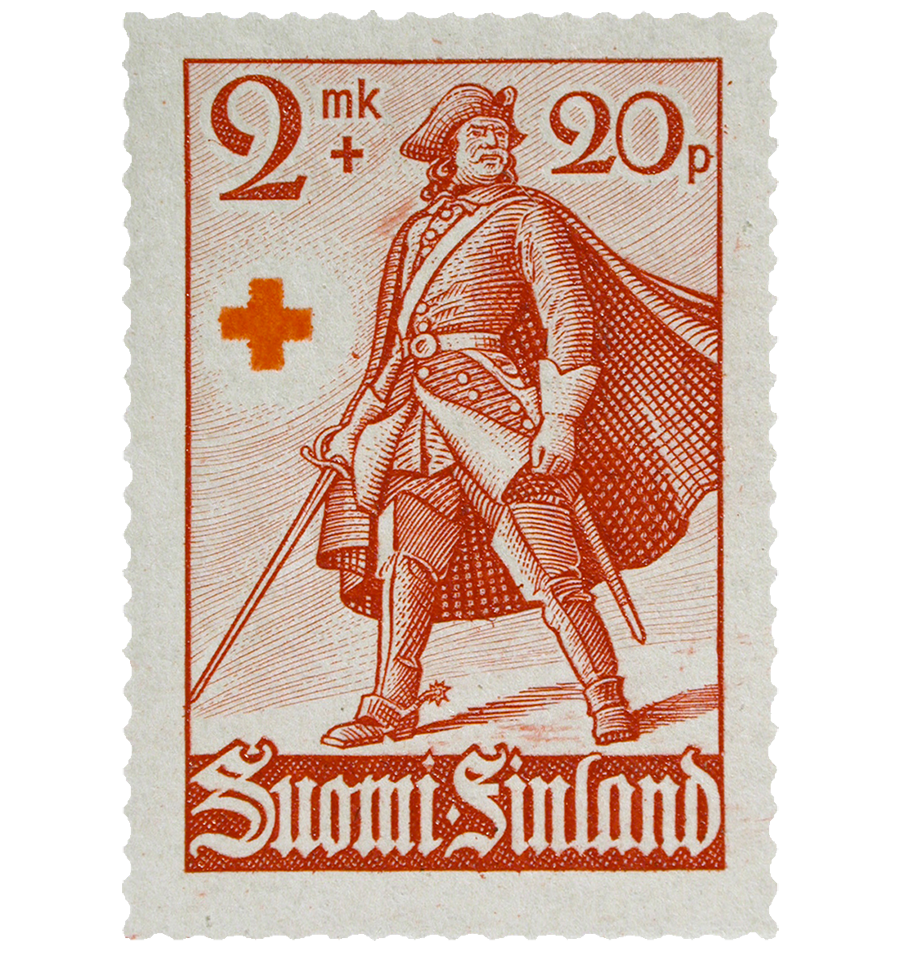
A Carolean soldier of the Swedish Army in his uniform. The postal stamp was designed by Signe Hammarsten Jansson in 1940.
Postal Museum
There was very little trading between towns in the 17th and 18th centuries due to restrictions, so there was no real need to build a road network. The trade ban in the Gulf of Bothnia, which was in force until 1765, prevented coastal towns from engaging in foreign trade, which was centralised in Turku.
Later there were towns that were allowed to be involved in foreign trade, while in some towns products could only be sold to people who lived nearby. Farmers sold their products at the market in a particular town.
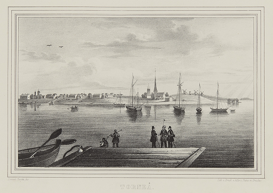
Goods, including tar, were transported across the Gulf of Bothnia from Finland to Sweden on ships. The drawing depicts Tornio in the 1840s.
Lennart Forstén, Historical Picture Collection, Finnish Heritage Agency
Copyright © Postimuseo | Design by Mediakettu
based on a template by WebThemez.com